DavesSpot
Latitude:37.90913
Longitude:-119.41928
GPS location Date/Time:08/03/2016 16:13:51 PDT
Message:Hello, I have reached my campsite for the day. All is well. I will report tomorrow morning.
Click the link below to see where I am located.
http://fms.ws/ZntBK/37.90913N/119.41928W
If the above link does not work, try this link:
http://maps.google.com/maps?f=q&hl=en&geocode=&q=37.90913,-119.41928&ll=37.90913,-119.41928&ie=UTF8&z=12&om=1
DavesSpot
You have received this message because DavesSpot has added you to their SPOT contact list.
Ready for Adventure
FindMeSPOT.com
Check-in/OK message from SPOT DavesSpot
DavesSpot
Latitude:37.87881
Longitude:-119.35832
GPS location Date/Time:08/03/2016 13:01:24 PDT
Message:On my way from Yosemite
Click the link below to see where I am located.
http://fms.ws/ZnS5W/37.87881N/119.35832W
If the above link does not work, try this link:
http://maps.google.com/maps?f=q&hl=en&geocode=&q=37.87881,-119.35832&ll=37.87881,-119.35832&ie=UTF8&z=12&om=1
DavesSpot
You have received this message because DavesSpot has added you to their SPOT contact list.
Ready for Adventure
FindMeSPOT.com
Day 19. Aug 17: Climbing Forester Pass. 14 Miles
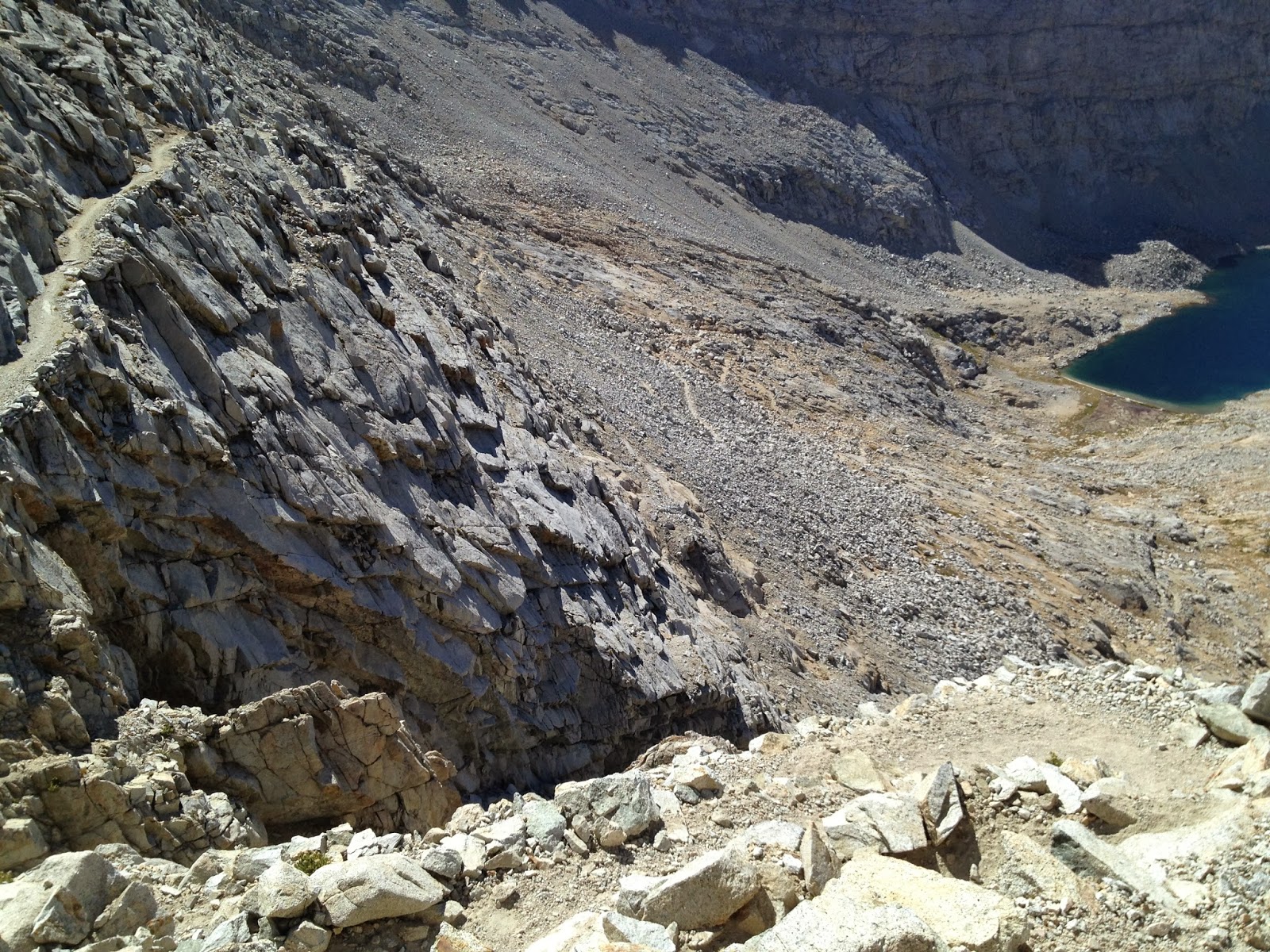
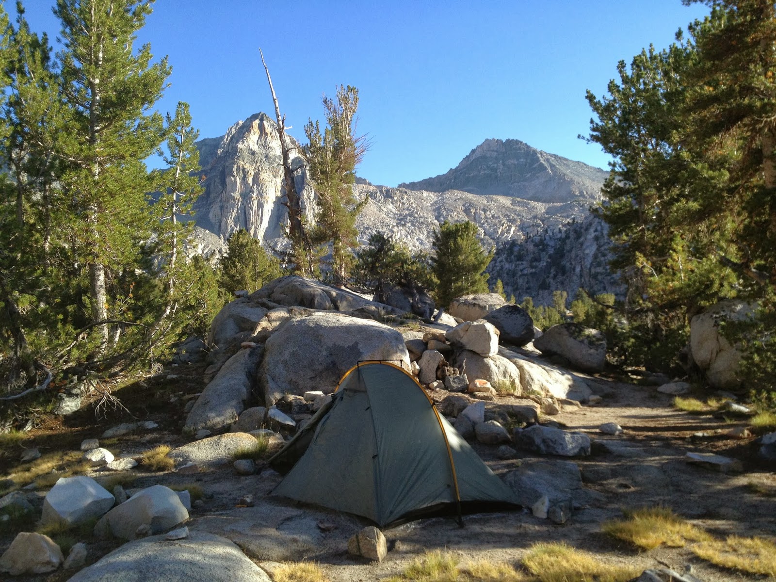
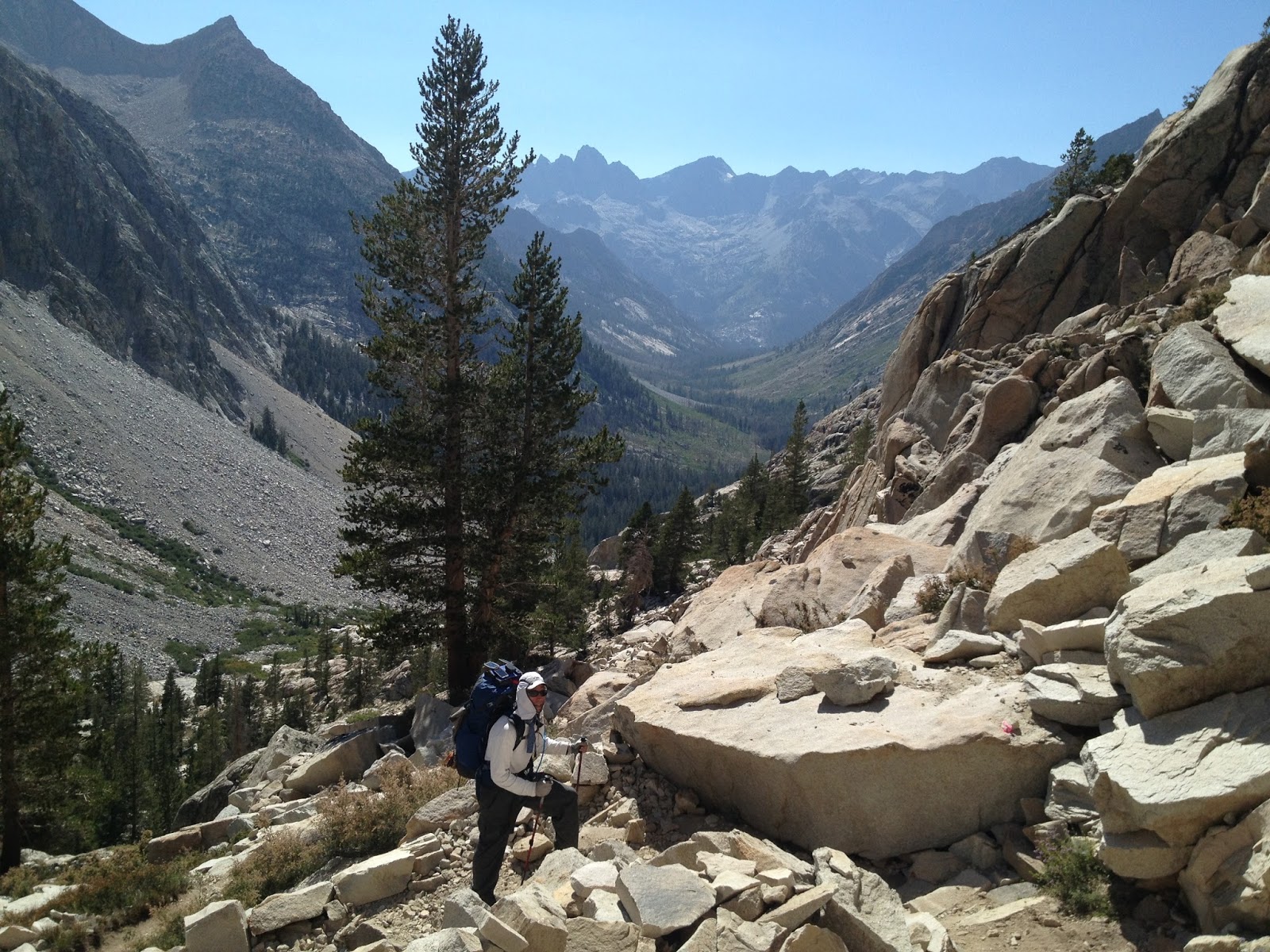
Today was a day I have been looking forward to for a long time. Forester Pass has always been an undiscovered mystery to me. It is the highest pass. It is the final pass. Crossing it commits you to an entirely different region from which you came. The southern face is a legendary sheer face. The northern face was..., well I don't know what to expect. As it turns out the northern face is a wonderfully sweeping expanse of granite and blue sky. I left Center Basin Creek junction at 6am and passed the last cluster of camps at 7am in the low lying juniper trees before the trail takes a 90 degree turn to the east. From there you are on the climb to Forester and it took me 3 hours.
The Pass had a great view of Bubbs Creek valley to the north and a true OMG view to the south. There was a big group atop Forester as we all began to converge on Whitney. The trail down was incredible. To think of the PCT class of 2011 and how they climbed the snow chute to scale the pass from the south: amazing!
After the long trek across the open basin I came to Tyndall creek and had some lunch and took a break. I pressed on to Wallace Creek, 4 miles past my intended camp at the Tyndall Frog ponds. Tyndall ponds were unimpressive and I would recommend Tyndall Creek over the Ponds. Big Horn Plateau looked vast and lonely. Mt Whitney was in view before descending to Wright creek and then on to my camp at Wallace Creek. Today was an epic day. The highest Pass so far and one of my longest mileage days. Today was a great day!
LEAVING CAMP
Dave's right here"
Latitude:36.73044
Longitude:-118.37346
GPS location Date/Time:08/17/2013 06:33:34 PDT
Message:Climb to ForesterPass. No rain:) DW&JP thanks
Click the link below to see where I am located.
http://maps.google.com/maps?f=q&hl=en&geocode=&q=36.73044,-118.37346&ll=36.73044,-118.37346&ie=UTF8&z=12&om=1
FORESTER PASS
Dave's right here"
Latitude:36.69460
Longitude:-118.37357
GPS location Date/Time:08/17/2013 09:58:32 PDT
Message:Atop Forester Pass! Epic indeed.Thank you all
Click the link below to see where I am located.
http://maps.google.com/maps?f=q&hl=en&geocode=&q=36.69460,-118.37357&ll=36.69460,-118.37357&ie=UTF8&z=12&om=1
TYNDALL CREEK
Dave's right here"
Latitude:36.63992
Longitude:-118.38844
GPS location Date/Time:08/17/2013 13:11:05 PDT
Message:Moving to Wallace Creek. Clear sky. 3 hrs.
Click the link below to see where I am located.
http://maps.google.com/maps?f=q&hl=en&geocode=&q=36.63992,-118.38844&ll=36.63992,-118.38844&ie=UTF8&z=12&om=1
WALLACE CREEK
Dave's right here"
Latitude:36.59397
Longitude:-118.37045
GPS location Date/Time:08/17/2013 15:57:31 PDT
Message:Camped at Wallace Creek. Great day w/o rain.
Click the link below to see where I am located.
http://maps.google.com/maps?f=q&hl=en&geocode=&q=36.59397,-118.37045&ll=36.59397,-118.37045&ie=UTF8&z=12&om=1
.JPG) |
| Great view north |
.JPG) |
| Wonderful. Epic. Grand |
.JPG) |
| Forester Pass finally in sight |
 |
| Happy Hiker |
 |
| Literally, unbelievable |
 |
| Great view but where are the Sequoias? |
 |
| Tyndall Frog Ponds |
 |
| Mt Whitney from Big Horn Plateau |
 |
| Approaching Wright Creek |
SPOT MESSAGES
LEAVING CAMP
Dave's right here"
Latitude:36.73044
Longitude:-118.37346
GPS location Date/Time:08/17/2013 06:33:34 PDT
Message:Climb to ForesterPass. No rain:) DW&JP thanks
Click the link below to see where I am located.
http://maps.google.com/maps?f=q&hl=en&geocode=&q=36.73044,-118.37346&ll=36.73044,-118.37346&ie=UTF8&z=12&om=1
FORESTER PASS
Dave's right here"
Latitude:36.69460
Longitude:-118.37357
GPS location Date/Time:08/17/2013 09:58:32 PDT
Message:Atop Forester Pass! Epic indeed.Thank you all
Click the link below to see where I am located.
http://maps.google.com/maps?f=q&hl=en&geocode=&q=36.69460,-118.37357&ll=36.69460,-118.37357&ie=UTF8&z=12&om=1
TYNDALL CREEK
Dave's right here"
Latitude:36.63992
Longitude:-118.38844
GPS location Date/Time:08/17/2013 13:11:05 PDT
Message:Moving to Wallace Creek. Clear sky. 3 hrs.
Click the link below to see where I am located.
http://maps.google.com/maps?f=q&hl=en&geocode=&q=36.63992,-118.38844&ll=36.63992,-118.38844&ie=UTF8&z=12&om=1
WALLACE CREEK
Dave's right here"
Latitude:36.59397
Longitude:-118.37045
GPS location Date/Time:08/17/2013 15:57:31 PDT
Message:Camped at Wallace Creek. Great day w/o rain.
Click the link below to see where I am located.
http://maps.google.com/maps?f=q&hl=en&geocode=&q=36.59397,-118.37045&ll=36.59397,-118.37045&ie=UTF8&z=12&om=1
Day 17 & 18. Aug 15 & 16: Re-Supply at Kearsarge Lakes via Glen Pass. 8 Miles & 8 Miles
At last, today is here. Today will be my final re-supply. This important rendezvous will be with my brother Don. An added bonus is that my good friend John will be there too. They are two of the finest men I know, and I am honored that they would sacrifice their time and energy to support me. We conjured up this idea months ago, and the time is finally now. I can't wait.
The first order of business is to climb Glen Pass. Unlike other passes on the JMT, it is very steep on the north side. From Rae Lakes, the trail starts up 1,300' and reaches 11,900' in two miles. I began to modify my mileage plan about 6 days ago so I would begin today at the base of Glen Pass, making today an 8 mile vs. 14 mile hike.
It was a beautiful morning as I started up the trail. Blue skies and light winds. There were quite a few hikers getting ready to go up, so I pushed ahead with a fast pace to stay ahead of the pack. I was also very eager to make contact with Don and John as early as possible. Finally I made it to the top by 10am. It only took 75 minutes instead of the 130 that my "Trail Math" had calculated.
By 1115am I was above Charlotte Lake and it was time to put our rendezvous plan into action. We both had maps that we had annotated with the same trail checkpoints: the same sheet of music as they say. I was getting close to my first checkpoint so I pulled out the walkie talkie I had been carrying since Reds Meadow on Day 6 and triggered the mike a few times. "Eagle One this is Red Dog, how copy?" came the reply. It was Don's voice. They were on top of Kearsarge Pass and apparently we have call signs!
I was beaming. It was a happy and grateful moment for me. My wife, my brother, my friend were all working behind the scenes to help me do this. Solo hiker? No, not really.
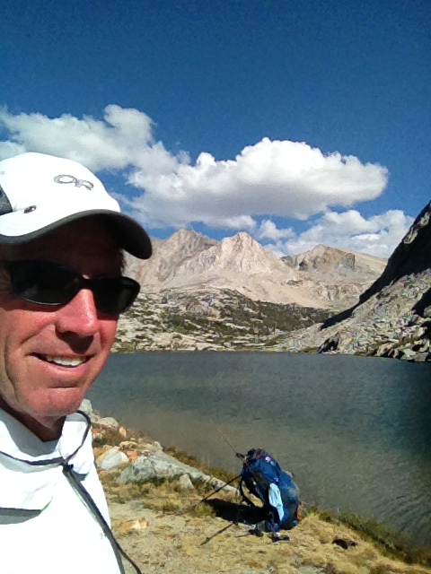
About two hours later I had covered the last 3 miles to find Don and John waiting for me under a tree next to Kearsarge Lakes.
The next morning, Don and John headed back up Kearsarge Pass and I headed south to Center Basin Creek along the JMT. This had been a very important event in my journey. I needed this food to continue hiking and it was really the only time I was directly dependent on someone else on the trail. They came through for me, and I will always be grateful.
LEAVING RAE LAKES
Dave's right here"
Latitude:36.80776
Longitude:-118.39972
GPS location Date/Time:08/15/2013 07:35:13 PDT
Message:Heading to Glen Pass &then my resupply crew!
Click the link below to see where I am located.
http://maps.google.com/maps?f=q&hl=en&geocode=&q=36.80776,-118.39972&ll=36.80776,-118.39972&ie=UTF8&z=12&om=1
GLEN PASS
Dave's right here"
Latitude:36.78958
Longitude:-118.41196
GPS location Date/Time:08/15/2013 10:07:16 PDT
Message:Glen Pass@10am! Blue skies. All's well.
Click the link below to see where I am located.
http://maps.google.com/maps?f=q&hl=en&geocode=&q=36.78958,-118.41196&ll=36.78958,-118.41196&ie=UTF8&z=12&om=1
RADIO CONTACT
Dave's right here"
Latitude:36.77738
Longitude:-118.42079
GPS location Date/Time:08/15/2013 11:36:49 PDT
Message:Radio contact made with DW&JP.
Click the link below to see where I am located.
http://maps.google.com/maps?f=q&hl=en&geocode=&q=36.77738,-118.42079&ll=36.77738,-118.42079&ie=UTF8&z=12&om=1
3 MESSAGES TO THE WIVES
Dave's right here"
Latitude:36.76773
Longitude:-118.38623
GPS location Date/Time:08/15/2013 13:44:50 PDT
Message:3 Amigos are all Happy&safe! Thx CWx2&LWP
GPS location Date/Time:08/15/2013 19:23:19 PDT
Message:3 Amigos say good nite to all. Well fed&safe
GPS location Date/Time:08/16/2013 08:49:07 PDT
Message:3Amigos departing ways.Great visit, great day
Click the link below to see where I am located.
http://maps.google.com/maps?f=q&hl=en&geocode=&q=36.76773,-118.38623&ll=36.76773,-118.38623&ie=UTF8&z=12&om=1
END OF DAY 18.
Dave's right here"
Latitude:36.73061
Longitude:-118.37341
GPS location Date/Time:08/16/2013 14:45:05 PDT
Message:At Camp. Gear ready 4 50/50 chance of rain.
Click the link below to see where I am located.
http://maps.google.com/maps?f=q&hl=en&geocode=&q=36.73061,-118.37341&ll=36.73061,-118.37341&ie=UTF8&z=12&om=1
The first order of business is to climb Glen Pass. Unlike other passes on the JMT, it is very steep on the north side. From Rae Lakes, the trail starts up 1,300' and reaches 11,900' in two miles. I began to modify my mileage plan about 6 days ago so I would begin today at the base of Glen Pass, making today an 8 mile vs. 14 mile hike.
It was a beautiful morning as I started up the trail. Blue skies and light winds. There were quite a few hikers getting ready to go up, so I pushed ahead with a fast pace to stay ahead of the pack. I was also very eager to make contact with Don and John as early as possible. Finally I made it to the top by 10am. It only took 75 minutes instead of the 130 that my "Trail Math" had calculated.
.JPG) |
| The Painted Lady towers over Rae Lakes. Glen Pass to the right |
.JPG) |
| Glen Pass at 11,924' |
.JPG) |
| Glenn Pass at 10am |
By 1115am I was above Charlotte Lake and it was time to put our rendezvous plan into action. We both had maps that we had annotated with the same trail checkpoints: the same sheet of music as they say. I was getting close to my first checkpoint so I pulled out the walkie talkie I had been carrying since Reds Meadow on Day 6 and triggered the mike a few times. "Eagle One this is Red Dog, how copy?" came the reply. It was Don's voice. They were on top of Kearsarge Pass and apparently we have call signs!
I was beaming. It was a happy and grateful moment for me. My wife, my brother, my friend were all working behind the scenes to help me do this. Solo hiker? No, not really.
About two hours later I had covered the last 3 miles to find Don and John waiting for me under a tree next to Kearsarge Lakes.
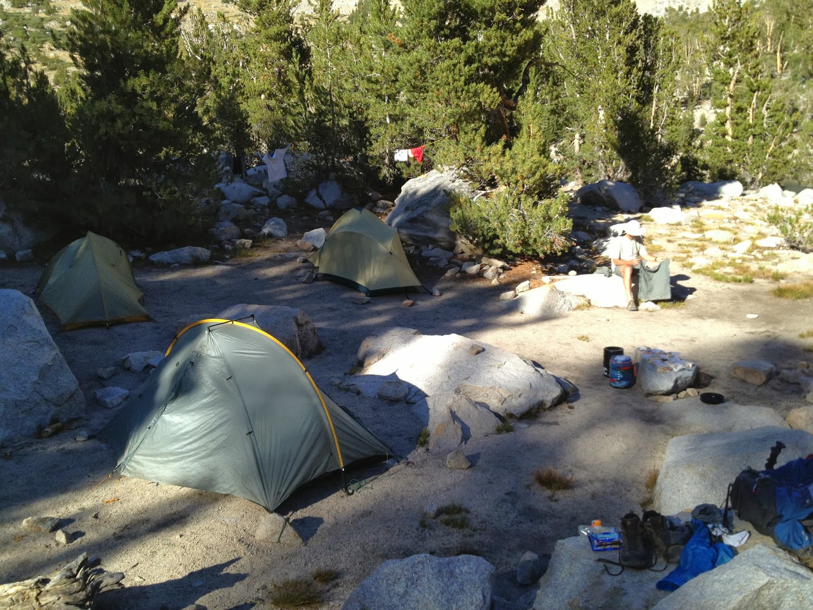 |
| Kearsarge Lakes Campsite |
 |
| Food Can is filled again, Thanks guys! |
 | ||
| John and Don enjoy dinner |
The next morning, Don and John headed back up Kearsarge Pass and I headed south to Center Basin Creek along the JMT. This had been a very important event in my journey. I needed this food to continue hiking and it was really the only time I was directly dependent on someone else on the trail. They came through for me, and I will always be grateful.
.JPG) |
| Dave, John, and Don: A Great Reunion on the John Muir Trail |
.JPG) |
| Vidette Meadow and Bubbs Creek valley leading to Forester Pass |
.JPG) |
| Looking back north from Bubbs Creek near my campsite |
SPOT MESSAGES
LEAVING RAE LAKES
Dave's right here"
Latitude:36.80776
Longitude:-118.39972
GPS location Date/Time:08/15/2013 07:35:13 PDT
Message:Heading to Glen Pass &then my resupply crew!
Click the link below to see where I am located.
http://maps.google.com/maps?f=q&hl=en&geocode=&q=36.80776,-118.39972&ll=36.80776,-118.39972&ie=UTF8&z=12&om=1
GLEN PASS
Dave's right here"
Latitude:36.78958
Longitude:-118.41196
GPS location Date/Time:08/15/2013 10:07:16 PDT
Message:Glen Pass@10am! Blue skies. All's well.
Click the link below to see where I am located.
http://maps.google.com/maps?f=q&hl=en&geocode=&q=36.78958,-118.41196&ll=36.78958,-118.41196&ie=UTF8&z=12&om=1
RADIO CONTACT
Dave's right here"
Latitude:36.77738
Longitude:-118.42079
GPS location Date/Time:08/15/2013 11:36:49 PDT
Message:Radio contact made with DW&JP.
Click the link below to see where I am located.
http://maps.google.com/maps?f=q&hl=en&geocode=&q=36.77738,-118.42079&ll=36.77738,-118.42079&ie=UTF8&z=12&om=1
3 MESSAGES TO THE WIVES
Dave's right here"
Latitude:36.76773
Longitude:-118.38623
GPS location Date/Time:08/15/2013 13:44:50 PDT
Message:3 Amigos are all Happy&safe! Thx CWx2&LWP
GPS location Date/Time:08/15/2013 19:23:19 PDT
Message:3 Amigos say good nite to all. Well fed&safe
GPS location Date/Time:08/16/2013 08:49:07 PDT
Message:3Amigos departing ways.Great visit, great day
Click the link below to see where I am located.
http://maps.google.com/maps?f=q&hl=en&geocode=&q=36.76773,-118.38623&ll=36.76773,-118.38623&ie=UTF8&z=12&om=1
END OF DAY 18.
Dave's right here"
Latitude:36.73061
Longitude:-118.37341
GPS location Date/Time:08/16/2013 14:45:05 PDT
Message:At Camp. Gear ready 4 50/50 chance of rain.
Click the link below to see where I am located.
http://maps.google.com/maps?f=q&hl=en&geocode=&q=36.73061,-118.37341&ll=36.73061,-118.37341&ie=UTF8&z=12&om=1
Day 16. Aug 14: Woods Creek to Rae Lakes. 6 Miles.
It was really cold this morning. This is the first time that I began my hike with an extra layer of clothes. This may have something to do with the fact that this camp area is in a low lying creek area.
 |
| Bundled up and leaving Woods Creek |
 |
| Almost to Dollar Lake. Looking back down to Woods Creek |
 |
| Dollar Lake |
However, my new priority was to get as far south into Rae Lakes as possible so I would be rested and ready to start my climb up Glen Pass in the morning. That would help me reach my resupply point closer to when Don and John would be arriving from Kearsarge Pass tomorrow.
The one thing about Rae lakes is that it gets a lot of visitors and therefore has a 2 night limit for campers. Not only does the JMT/PCT pass through here, but so does a loop trail that starts from Cedar Grove to the west. Cedar Grove links Hwy 180 from Fresno and therefore gives easy access from the central valley. Likewise, Kearsarge Pass creates easy access from the east along Hwy 395.
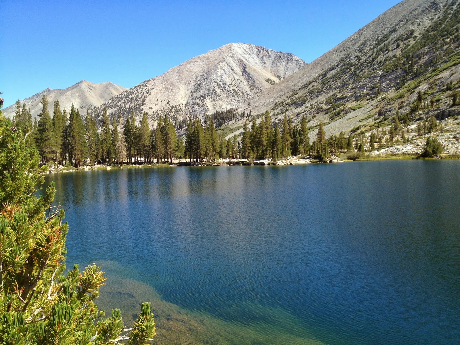
After passing Dollar lake I came to Arrowhead Lake and a great view of the iconic Fin Dome that is the signature feature of Rae lakes. I had a nice talk with NP ranger Dave Gordon and he warned me about a big group of noisy campers and suggested some better spots. I stopped by to see his new cabin that he was very proud of. The cabin is a huge improvement over the plywood and canvas one they had in 2010.
 |
| Fin Dome |
 |
| Rae Lakes Ranger cabin |
I picked a campsite at the middle lake around noon. It was now a warm clear day and I set upon getting cleaned up and did my laundry.
 |
| Rae Lakes campsite |
 |
| Laundry day |
After laundry detail I also gave myself a much needed pedicure. A Swiss Army pedicure to be exact.
I realize this isn't really a blog-worthy subject but I must happily comment on how my feet came full circle from blistered and tender to fully healed and trail tough. I did not expect that at all. Daily attention to problem areas and letting the feet breathe vs. constant bandaging was the key.
The Injinji brand toe socks I wore every day helped prevent toe-to-toe blisters and cuts. I used their lightweight running version as a liner under my mid-weight hiking socks. I thought these odd little toe socks were great and would definitely use them again.
One thing I did that may surprise many is that I cut a hole out of the back of each boot to stop the recurring heel blisters. I had hiked this way since day 4 and never again had an issue with heel pain. After getting knocked off this trail in 2012 due to blisters, the incision decision was easy. Sometimes you just gotta to do what you gotta do.
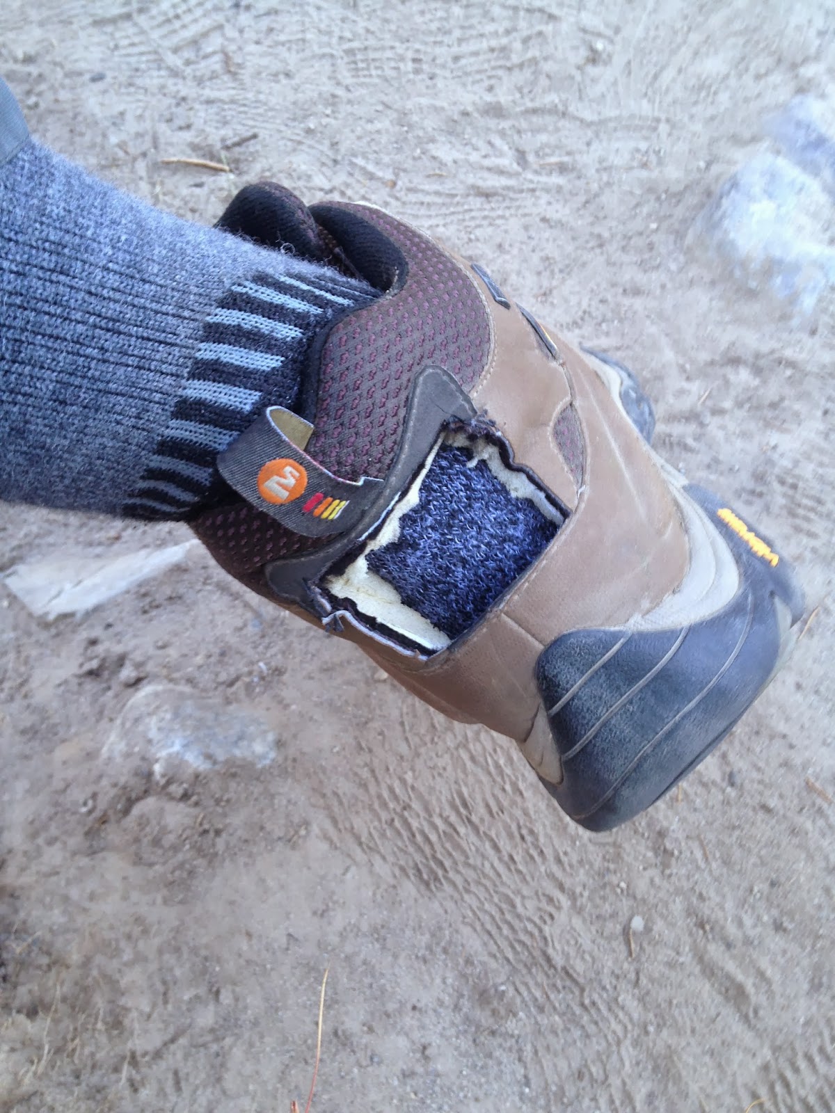 |
| Solution |
 |
| Problem |
.JPG) |
| No defeat for these feet |
What really surprised me is how bad my fingertips are cracking. Very deep and painful.

Daily SPOT Message
Dave's right here"
Latitude:36.80774
Longitude:-118.39978
GPS location Date/Time:08/14/2013 13:07:29 PDT
Message:Camped at Rae Lk. DBW&JLP hike safe&thanx. CU
Click the link below to see where I am located.
http://maps.google.com/maps?f=q&hl=en&geocode=&q=36.80774,-118.39978&ll=36.80774,-118.39978&ie=UTF8&z=12&om=1
Day 15. Aug 13: Bench lake to Woods Creek via Pinchot Pass. 12 Miles.
My original thought about having a day off at Bench Lake has changed.
I will now take my day off at Rae lakes. A half day off anyway. The benefit is that Rae puts me very close to my resupply two days from now. I can't make Rae from here so I will go to Woods creek today and then a short half day hike to Rae tomorrow.
Fishing was lots of fun at Bench. Rainbows at the deeper east end and Browns at the shallow warmer west end. I spent some time fishing as I began my hike back to the JMT. Before starting up to Pinchot pass I fished some more at Lake Marjorie for the many brook trout there.
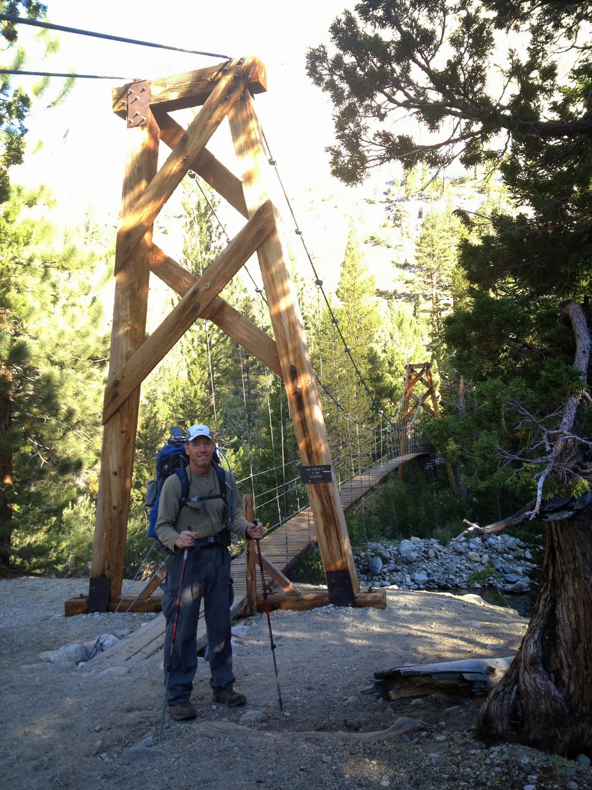
Pinchot Pass was very much like Mather Pass two days ago. Pleasant switchbacks going up to 12,100' and then a big, wide open basin below to the south. From the pass you can see how the water flows down and then turns right, to the west. This time it was Woods creek that I would follow downstream until I came to the big crazy suspension bridge. I picked a campsite on the other side of the bridge. From there, the JMT starts to climb back up to Rae lakes.
Morning
Dave's right here"
Latitude:36.95055
Longitude:-118.46577
GPS location Date/Time:08/13/2013 08:49:37 PDT
Message:Leaving Bench Lake for the Woods Creek Bridge
Click the link below to see where I am located.
http://maps.google.com/maps?f=q&hl=en&geocode=&q=36.95055,-118.46577&ll=36.95055,-118.46577&ie=UTF8&z=12&om=1
Evening
Dave's right here"
Latitude:36.87294
Longitude:-118.43800
GPS location Date/Time:08/13/2013 17:55:32 PDT
Message:Camped@the bridge. Cheesy Strogo&potatos. Yum
Click the link below to see where I am located.
http://maps.google.com/maps?f=q&hl=en&geocode=&q=36.87294,-118.43800&ll=36.87294,-118.43800&ie=UTF8&z=12&om=1
I will now take my day off at Rae lakes. A half day off anyway. The benefit is that Rae puts me very close to my resupply two days from now. I can't make Rae from here so I will go to Woods creek today and then a short half day hike to Rae tomorrow.
Fishing was lots of fun at Bench. Rainbows at the deeper east end and Browns at the shallow warmer west end. I spent some time fishing as I began my hike back to the JMT. Before starting up to Pinchot pass I fished some more at Lake Marjorie for the many brook trout there.
 |
| Lake Marjorie |
Pinchot Pass was very much like Mather Pass two days ago. Pleasant switchbacks going up to 12,100' and then a big, wide open basin below to the south. From the pass you can see how the water flows down and then turns right, to the west. This time it was Woods creek that I would follow downstream until I came to the big crazy suspension bridge. I picked a campsite on the other side of the bridge. From there, the JMT starts to climb back up to Rae lakes.
 |
| Looking back to Lake Marjorie from Pinchot Pass |
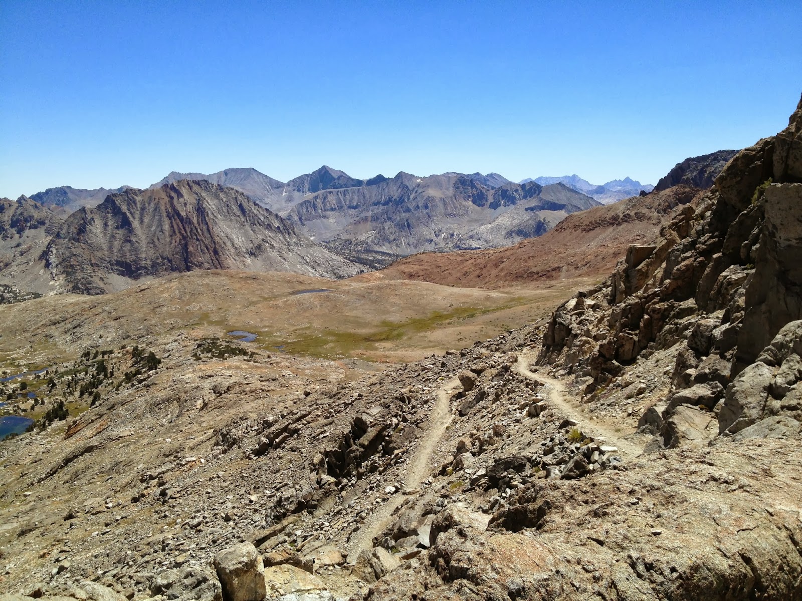 |
| Looking south to the trail ahead from Pinchot Pass |
 |
| Woods Creek |
 |
| Suspension Bridge over Woods Creek |
Daily SPOT Messages
Morning
Dave's right here"
Latitude:36.95055
Longitude:-118.46577
GPS location Date/Time:08/13/2013 08:49:37 PDT
Message:Leaving Bench Lake for the Woods Creek Bridge
Click the link below to see where I am located.
http://maps.google.com/maps?f=q&hl=en&geocode=&q=36.95055,-118.46577&ll=36.95055,-118.46577&ie=UTF8&z=12&om=1
Evening
Dave's right here"
Latitude:36.87294
Longitude:-118.43800
GPS location Date/Time:08/13/2013 17:55:32 PDT
Message:Camped@the bridge. Cheesy Strogo&potatos. Yum
Click the link below to see where I am located.
http://maps.google.com/maps?f=q&hl=en&geocode=&q=36.87294,-118.43800&ll=36.87294,-118.43800&ie=UTF8&z=12&om=1
Day 14. Aug 12: Upper Palisades Lake to Bench Lake via Mather Pass. 12 Miles.
Today was a great day.
Great weather. A solitary climb to Mather Pass. Lunch with friends. A spooky walk to Bench Lake. And catching a Brown Trout.
Mather Pass, at 12,100' gives you an amazing view in every direction. The fact that it takes a few days of sweat to get here, makes it even better. From the top of Mather, looking south, I could see the vast basin below. Something red caught my eye. Just a tiny speck of red. It was Randy's retro red Kelty backpack and Sonoma Slim's sea-foam green shirt. The Dynamic Duo. They were down in the Upper Basin heading south well ahead of me. We were like the tortoise and the hare. I am faster but they are always ahead of me. I broke decorum and let out a loud yell. I saw them stop in their tracks. Later at lunch Randy said he guessed it was me in my once-white shirt.
I caught up to the Dynamic Duo at a stream crossing well down the Upper Basin. They represent one unique aspect of long range hiking: camaraderie through a shared experience. Though I was a solo hiker in this vast space, it was reassuring to meet the same good folks from time to time along the trail. I first met them at the Muir Ranch resupply on Day 10. We crossed Evolution Creek at the same time, then I saw them arrive at Evolution lake at sundown, later atop Muir Pass, again at the Bishop Pass trail junction, and then again today. Randy was a horse-shoe'r from NH and SS was on his 5th JMT trip as Randy's friend and guide. Today, I was halfway through my lunch and they bid me farewell. I would lap them again before crossing the Kings River.
After crossing the Kings river and a steep 800' climb I came to the Bench Lake trail junction. Bench Lake was on my bucket list for various reasons:
1. It was a change of pace from the JMT campsites.
2. It was said to have good fishing.
3. And it was a key location in the true account of a NP Ranger who goes missing in 1996.
This true story is told in a great book; The Last Season. It is a must read for anyone who has hiked the eastern Sierras.

I eagerly set off down the two mile trail to Bench Lake. Then it got kinda creepy. The trees got thicker and the trail began to fade into a 2" rut. Then it got weird. A backpack hanging from the trees. I was now keenly aware of how secure you feel on the JMT super highway compared to this off the grid path. I started adding GPS way-points to the map on my iPhone App to ensure I found my way back. Then I began to track one pair of fresh footprints. A men's size 10-ish boot. Vibram sole logo. Heavy lugs and a "+" shaped tread like a rounded 1/8" tile spacer. I was also looking for signs of bear scat, none. Although I was feeling out of my element, I was confident that at least I was paying attention to my surroundings.
I was now at the lake and the "fisherman's trail" was wide and open. Then, sure enough, I spotted a lone male hiker coming towards me on the trail. We chatted briefly about this and that. The CSI in me wanted to ask to see his boot. But the city boy in me told him...
"If you see my two friends on your way back to the JMT, tell them to meet me at the far end of the lake."
Obviously, I am hiking alone and I had no intention of going to the far end of the lake; not now that is. Later, reflecting on the encounter, I felt a bit cheesy about my lack of trust and the misinformation I gave to my fellow hiker. But I also feel that when you are solo in the wilderness you need to trust your instincts and you must always keep yourself in a defensible position, whether that be from mother nature or your fellow man.
Earlier I had mentioned the Dynamic Duo as a unique and positive aspect of hiking the JMT. I guess my encounter at Bench Lake should have been the same. But it just wasn't the same. The location. The remoteness. The vibe. The instinct.
I set up a nice camp with trees to block the wind but open enough to watch the sunset. Before it got dark I was able catch a few Brown Trout. This completed my first Sierra Slam. All four types of trout: Rainbow, Brook, Brown, and Golden. A Sierra Slam is suppose to take place during a single calender day, which makes it so difficult. But I was willing to count it during a single JMT trip. Who will know?

Morning
Dave's right here"
Latitude:37.05212
Longitude:-118.47145
GPS location Date/Time:08/12/2013 08:09:59 PDT
Message:Happy Monday. On my way up to Mather Pass. :)
Click the link below to see where I am located.
http://maps.google.com/maps?f=q&hl=en&geocode=&q=37.05212,-118.47145&ll=37.05212,-118.47145&ie=UTF8&z=12&om=1
Mather Pass
Dave's right here"
Latitude:37.03124
Longitude:-118.46010
GPS location Date/Time:08/12/2013 10:20:00 PDT
Message:Atop Mather Pass!EndlessBlueSky. Totally solo
Click the link below to see where I am located.
http://maps.google.com/maps?f=q&hl=en&geocode=&q=37.03124,-118.46010&ll=37.03124,-118.46010&ie=UTF8&z=12&om=1
FindMeSPOT.com
Evening
Dave's right here"
Latitude:36.95052
Longitude:-118.46573
GPS location Date/Time:08/12/2013 17:53:59 PDT
Message:Camped at Bench Lake. Rtn 2 JMT in AM. Cheers
Click the link below to see where I am located.
http://maps.google.com/maps?f=q&hl=en&geocode=&q=36.95052,-118.46573&ll=36.95052,-118.46573&ie=UTF8&z=12&om=1
FindMeSPOT.com
Great weather. A solitary climb to Mather Pass. Lunch with friends. A spooky walk to Bench Lake. And catching a Brown Trout.
Mather Pass, at 12,100' gives you an amazing view in every direction. The fact that it takes a few days of sweat to get here, makes it even better. From the top of Mather, looking south, I could see the vast basin below. Something red caught my eye. Just a tiny speck of red. It was Randy's retro red Kelty backpack and Sonoma Slim's sea-foam green shirt. The Dynamic Duo. They were down in the Upper Basin heading south well ahead of me. We were like the tortoise and the hare. I am faster but they are always ahead of me. I broke decorum and let out a loud yell. I saw them stop in their tracks. Later at lunch Randy said he guessed it was me in my once-white shirt.
.JPG) |
| Daybreak |
.JPG) |
| Climbing to Mather Pass |
.JPG) |
| The Upper Basin. Headwaters of the Kings River, Middle Fork |
 |
| Randy and Sonoma Slim, the Dynamic Duo |
I caught up to the Dynamic Duo at a stream crossing well down the Upper Basin. They represent one unique aspect of long range hiking: camaraderie through a shared experience. Though I was a solo hiker in this vast space, it was reassuring to meet the same good folks from time to time along the trail. I first met them at the Muir Ranch resupply on Day 10. We crossed Evolution Creek at the same time, then I saw them arrive at Evolution lake at sundown, later atop Muir Pass, again at the Bishop Pass trail junction, and then again today. Randy was a horse-shoe'r from NH and SS was on his 5th JMT trip as Randy's friend and guide. Today, I was halfway through my lunch and they bid me farewell. I would lap them again before crossing the Kings River.
After crossing the Kings river and a steep 800' climb I came to the Bench Lake trail junction. Bench Lake was on my bucket list for various reasons:
1. It was a change of pace from the JMT campsites.
2. It was said to have good fishing.
3. And it was a key location in the true account of a NP Ranger who goes missing in 1996.
This true story is told in a great book; The Last Season. It is a must read for anyone who has hiked the eastern Sierras.

.JPG) |
| Looking back east from the Bench Lake trail |
I eagerly set off down the two mile trail to Bench Lake. Then it got kinda creepy. The trees got thicker and the trail began to fade into a 2" rut. Then it got weird. A backpack hanging from the trees. I was now keenly aware of how secure you feel on the JMT super highway compared to this off the grid path. I started adding GPS way-points to the map on my iPhone App to ensure I found my way back. Then I began to track one pair of fresh footprints. A men's size 10-ish boot. Vibram sole logo. Heavy lugs and a "+" shaped tread like a rounded 1/8" tile spacer. I was also looking for signs of bear scat, none. Although I was feeling out of my element, I was confident that at least I was paying attention to my surroundings.
I was now at the lake and the "fisherman's trail" was wide and open. Then, sure enough, I spotted a lone male hiker coming towards me on the trail. We chatted briefly about this and that. The CSI in me wanted to ask to see his boot. But the city boy in me told him...
"If you see my two friends on your way back to the JMT, tell them to meet me at the far end of the lake."
Obviously, I am hiking alone and I had no intention of going to the far end of the lake; not now that is. Later, reflecting on the encounter, I felt a bit cheesy about my lack of trust and the misinformation I gave to my fellow hiker. But I also feel that when you are solo in the wilderness you need to trust your instincts and you must always keep yourself in a defensible position, whether that be from mother nature or your fellow man.
Earlier I had mentioned the Dynamic Duo as a unique and positive aspect of hiking the JMT. I guess my encounter at Bench Lake should have been the same. But it just wasn't the same. The location. The remoteness. The vibe. The instinct.
.JPG) |
| The disappearing trail |
.JPG) |
| Bench Lake |
I set up a nice camp with trees to block the wind but open enough to watch the sunset. Before it got dark I was able catch a few Brown Trout. This completed my first Sierra Slam. All four types of trout: Rainbow, Brook, Brown, and Golden. A Sierra Slam is suppose to take place during a single calender day, which makes it so difficult. But I was willing to count it during a single JMT trip. Who will know?
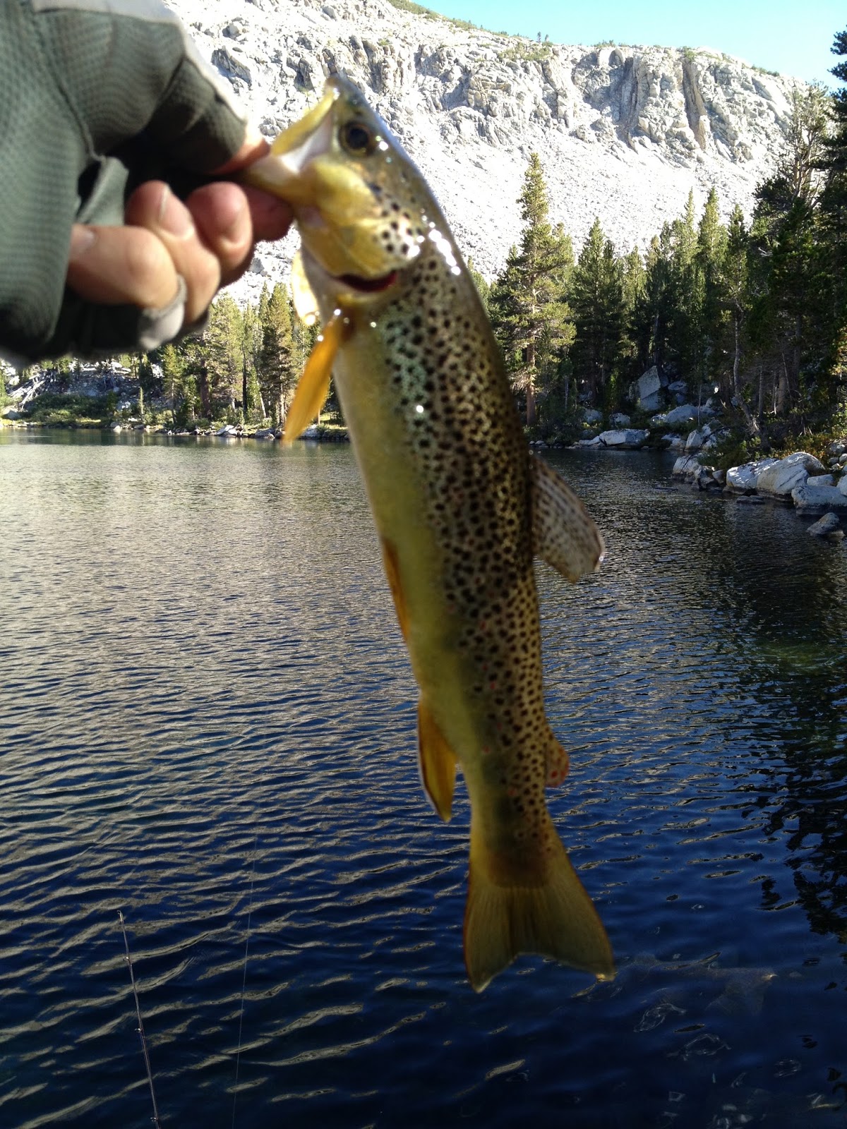 |
| Brown Trout (Salmo Trutta) |


Daily SPOT Messages
Morning
Dave's right here"
Latitude:37.05212
Longitude:-118.47145
GPS location Date/Time:08/12/2013 08:09:59 PDT
Message:Happy Monday. On my way up to Mather Pass. :)
Click the link below to see where I am located.
http://maps.google.com/maps?f=q&hl=en&geocode=&q=37.05212,-118.47145&ll=37.05212,-118.47145&ie=UTF8&z=12&om=1
Mather Pass
Dave's right here"
Latitude:37.03124
Longitude:-118.46010
GPS location Date/Time:08/12/2013 10:20:00 PDT
Message:Atop Mather Pass!EndlessBlueSky. Totally solo
Click the link below to see where I am located.
http://maps.google.com/maps?f=q&hl=en&geocode=&q=37.03124,-118.46010&ll=37.03124,-118.46010&ie=UTF8&z=12&om=1
FindMeSPOT.com
Evening
Dave's right here"
Latitude:36.95052
Longitude:-118.46573
GPS location Date/Time:08/12/2013 17:53:59 PDT
Message:Camped at Bench Lake. Rtn 2 JMT in AM. Cheers
Click the link below to see where I am located.
http://maps.google.com/maps?f=q&hl=en&geocode=&q=36.95052,-118.46573&ll=36.95052,-118.46573&ie=UTF8&z=12&om=1
FindMeSPOT.com
Day 13. Aug 11: Big Pete Meadow to Upper Palisades Lake. 14 Miles
Certain doubt.
Two simple words. Opposites. Together they defined my state of mind.
I wanted to exit the trail and end this string of long sleepless nights. Bishop Pass trail was a mile from my tent. 12 trail miles and I could be watching Sunday night football from a motel room in Bishop.
After all, back in 2010 I had already hiked the next 50 miles that were now in front of me.
I knew I wanted to finish atop Mt Whitney but the ease of quitting was overpowering.
I was locked in a mental tug-of-war during the last hours before sunrise. At some point I asked my late brother Steve for his advice. I wrote about him in the My Team tab of this Blog and now I was asking for his help. "Steve, what should I do? What would you do?" His answer became my decision.
" This camping is a bunch of BS! Lets get a clean room and a decent meal!", Steve said.
At that instant I knew I was going to finish atop Mt Whitney.
I just laughed at the clarity of the message my mind had conjured up.
Steve was not a camping type. He would not do this nonsense. I would.
So snap out of this mid-journey funk and carry on.
After Trip Note: A few weeks later my good friend John (see day 17/18) sent me an enote with a motivational message attached. I wish I had it with me then. I am certain it articulates the inner voice that kept me in the debate that night, to stand up against the overpowering voice to quit. Thanks again John.
 Back on the trail!
It was a great morning with cool temps and blue sky. My goal was to get to the golden staircase around mid afternoon so I could find my old camp by around 5pm. The walk down to Grouse meadow was a breeze. I had a nice chat with the ranger at his new cabin at the junction to Bishop Pass. He mentioned that there were Brown Trout in Bench Lake so I filed that away as another reason to stop there tomorrow.
After my bout with doubt this morning I realized that this stretch of trail was helping me. It was like a familiar street that I knew well and the miles seemed to go by faster. As it turned out, my old campsite from 2010 was waiting for me. The nearby stream was just as I remembered it and the trip up to Mather Pass in the morning was easy to visualize. I am so glad I continued. This will definitely be worth it.
Morning
Latitude:37.10509
Longitude:-118.60074
GPS location Date/Time:08/11/2013 09:35:39 PDT
Message:Back on JMT. Happy Birthday Allie!
Click the link below to see where I am located.
http://maps.google.com/maps?f=q&hl=en&geocode=&q=37.10509,-118.60074&ll=37.10509,-118.60074&ie=UTF8&z=12&om=1
Evening
Latitude:37.05219
Longitude:-118.47145
GPS location Date/Time:08/11/2013 17:28:46 PDT
Message:Same Camp as2010.Good karma,good day. Luv2all
Click the link below to see where I am located.
http://maps.google.com/maps?f=q&hl=en&geocode=&q=37.05219,-118.47145&ll=37.05219,-118.47145&ie=UTF8&z=12&om=1
Two simple words. Opposites. Together they defined my state of mind.
I wanted to exit the trail and end this string of long sleepless nights. Bishop Pass trail was a mile from my tent. 12 trail miles and I could be watching Sunday night football from a motel room in Bishop.
After all, back in 2010 I had already hiked the next 50 miles that were now in front of me.
I knew I wanted to finish atop Mt Whitney but the ease of quitting was overpowering.
I was locked in a mental tug-of-war during the last hours before sunrise. At some point I asked my late brother Steve for his advice. I wrote about him in the My Team tab of this Blog and now I was asking for his help. "Steve, what should I do? What would you do?" His answer became my decision.
" This camping is a bunch of BS! Lets get a clean room and a decent meal!", Steve said.
At that instant I knew I was going to finish atop Mt Whitney.
I just laughed at the clarity of the message my mind had conjured up.
Steve was not a camping type. He would not do this nonsense. I would.
So snap out of this mid-journey funk and carry on.
After Trip Note: A few weeks later my good friend John (see day 17/18) sent me an enote with a motivational message attached. I wish I had it with me then. I am certain it articulates the inner voice that kept me in the debate that night, to stand up against the overpowering voice to quit. Thanks again John.

It was a great morning with cool temps and blue sky. My goal was to get to the golden staircase around mid afternoon so I could find my old camp by around 5pm. The walk down to Grouse meadow was a breeze. I had a nice chat with the ranger at his new cabin at the junction to Bishop Pass. He mentioned that there were Brown Trout in Bench Lake so I filed that away as another reason to stop there tomorrow.
 |
| Grouse Meadow |
 |
| Headed east up the Palisades Valley |
 |
| Starting up the Golden Staircase. Looking back west to where this Palisades Valley meets LeConte Canyon in the distance. |
Climbing the Golden Staircase up to Palisades Basin
After my bout with doubt this morning I realized that this stretch of trail was helping me. It was like a familiar street that I knew well and the miles seemed to go by faster. As it turned out, my old campsite from 2010 was waiting for me. The nearby stream was just as I remembered it and the trip up to Mather Pass in the morning was easy to visualize. I am so glad I continued. This will definitely be worth it.
 |
| On the Staircase |
 . . |
| Happy Camper at Lower Lake. Thanks Steve! |
 |
| Headed to the laundromat |
.JPG) |
| The end of a good day: A table for one, with a view. |
Daily SPOT Messages
Morning
Latitude:37.10509
Longitude:-118.60074
GPS location Date/Time:08/11/2013 09:35:39 PDT
Message:Back on JMT. Happy Birthday Allie!
Click the link below to see where I am located.
http://maps.google.com/maps?f=q&hl=en&geocode=&q=37.10509,-118.60074&ll=37.10509,-118.60074&ie=UTF8&z=12&om=1
Evening
Latitude:37.05219
Longitude:-118.47145
GPS location Date/Time:08/11/2013 17:28:46 PDT
Message:Same Camp as2010.Good karma,good day. Luv2all
Click the link below to see where I am located.
http://maps.google.com/maps?f=q&hl=en&geocode=&q=37.05219,-118.47145&ll=37.05219,-118.47145&ie=UTF8&z=12&om=1
Subscribe to:
Posts (Atom)
